|
|
Home | Contacts (Opens in a new tab) | Collaborators | Technical Specification | Mapping Scotland: An Essay | Useful Links | Copyright and Reproductions | Accessibility (Opens in a new tab) About the ProjectCharting the Nation is a collaborative digital imaging and cataloguing project with the primary aim of widening access to maps of Scotland and their associated texts dating from ca. 1550 to 1740. This three-year project (1999-2002) was funded by a major award to the University of Edinburgh from the Research Support Libraries Programme (Opens in a new tab) (RSLP), on behalf of the Scottish Higher Education Funding Council (SHEFC). Additional funding was received from the Scottish Cultural Resources Access Network (SCRAN (Opens in a new tab)) and the National Library of Scotland. Although Charting the Nation is now managed by Edinburgh University Library, the development phase took place within the University's Department of Geography. The project involves a core consortium of 9 other higher education and national institutions within the United Kingdom:
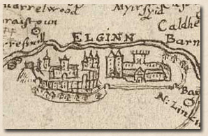
See full list of collaborating institutions Why Charting the Nation?Charting the Nation is important because of the significance of historic maps and related textual material for research and education in numerous disciplines. These include historical geography, cartographic history, maritime history, architectural history, archaeology, environmental history, and even for research on the evolution of ideas about the shape of the nation itself. However, many of the map and archive sources relating to the cartographic history of Scotland are fragile, unique, and rare. As a result, holding institutions have not been able hitherto to make them as widely available to researchers as they might wish. An additional problem for researchers has been the wide dispersion of the maps throughout the UK, and the fact that many related textual archives are located in different institutions hundreds of miles apart. Charting the Nation brings all these related materials together in an innovative and accessible way. The time period: 1550-1740At its inception, the project was planned to incorporate maps and relevant textual archival material dating from post 1590, the period immediately following the late sixteenth century field mapping of much of Scotland by Timothy Pont (1565 or 6-ca. 1614). The work of Pont was the subject of a major 5 year research project (Project Pont (Opens in a new tab)) from 1996 to 2001. That project was led by the National Library of Scotland, but it also involved several higher education institutions including the Department of Geography of the University of Edinburgh. Digital images of Pont's manuscript maps (Opens in a new tab) are available at the National Library of Scotland web site. In practice, Charting the Nation has been able to incorporate a significant number items that pre-date the work of Pont, the earliest of which is currently a manuscript map of the English/Scottish border, dated 1552 (image no: 00003444). |
|
|
The formal end date of 1740 was chosen for the project because it is recognised that during the 1740s there was a 'new beginning' for mapping in Scotland (and indeed in Britain), a development characterised by adoption of 'standard' mapping practices by the Military Survey under General William Roy. (The important Roy map is now available online (Opens in a new tab), courtesy of the British Library and SCRAN). Again, however, in practice a number of maps from the later eighteenth century have been included in Charting the Nation, in particular a significant body of manuscript estate plans that cannot be dated with certainty. |
|
|
|
© Crown copyright/National Library of Scotland |
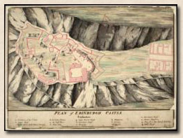
The Board of Ordnance collectionAlso included on this web site is the important Board of Ordnance (Opens in a new tab) collection of military maps and architectural plans now held by the National Library of Scotland. These date from ca. 1690 to ca. 1820. All these maps and plans were scanned and are made available here in order to maintain the integrity of the collection. |
|
|
Home | Contacts (Opens in a new tab) | Collaborators | Technical Specification | Mapping Scotland: An Essay | Useful Links | Copyright and Reproductions | Accessibility (Opens in a new tab) Published by Edinburgh University Library |
||